Tugu Golong Gilig is erected
The first monument was built under Hamengku Buwana I. Its cylinder and sphere formed the golong-gilig symbol and expressed unity between ruler and people.
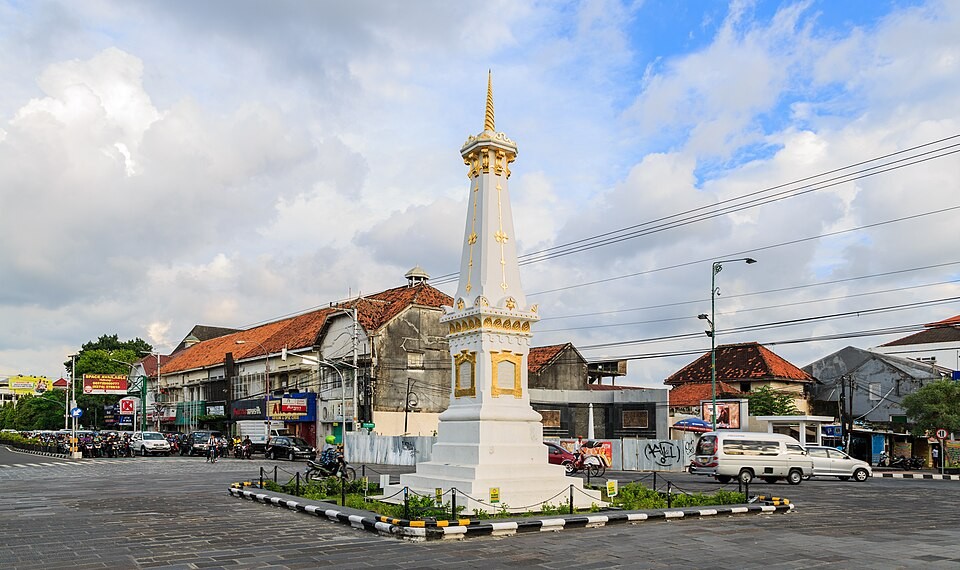
Tugu Pal Putih · Marker of the Philosophical Axis
Tugu Jogja is more than a photo backdrop. It stands at a crossroads as a marker of memory, direction, and a long conversation between the palace and the city.
A landmark, not an island
North of the Yogyakarta Palace, Tugu Pal Putih marks the junction that leads toward Margo Utomo, Malioboro, and the older city districts. Pause for a few minutes and observe the traffic rhythm, colonial-era streetscape, and urban lines that meet here.
A trace of time
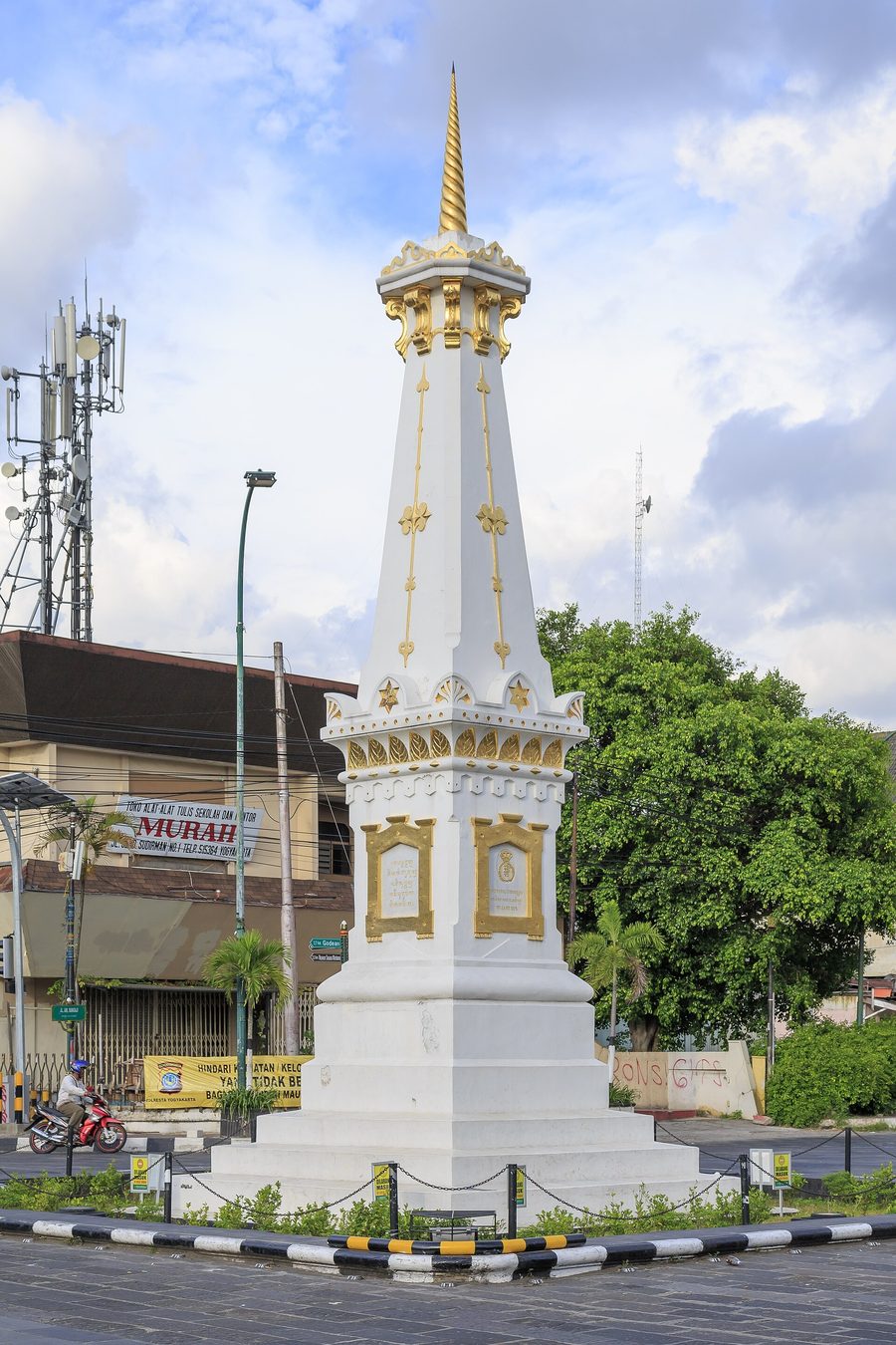
The monument visible today is a layer of history. Its Pal Putih name recalls its white appearance and later form, while its earlier Golong Gilig shape remains a civic memory of unity.
The first monument was built under Hamengku Buwana I. Its cylinder and sphere formed the golong-gilig symbol and expressed unity between ruler and people.
The major earthquake of 10 June damaged the original Golong Gilig monument.
It was inaugurated again under Hamengku Buwana VII in a square, tapering form—the Pal Putih silhouette recognised today.
Reading the place
Tugu is best understood as part of a larger cultural landscape. These notes distinguish historical record, cultural interpretation, and stories circulating in public space, so a visit need not end with a single photograph.
Tugu sits on the north–south line that connects Merapi, the Palace, Panggung Krapyak, and the Southern Sea. Heritage interpretation reads this arrangement as a Javanese expression of relationships among people, nature, and the Creator.
The earlier cylindrical-and-spherical form was known as Golong Gilig. The Palace’s account describes it as a symbol of unity between people and ruler, and relates it to the idea of Manunggaling Kawula Gusti.
Local stories add texture to a visit. Treat them as an invitation to ask questions rather than as settled fact; for dates, architecture, and physical change, consult cultural-institution records.
Field notes
Tugu sits inside an active intersection. Treat it as a viewpoint, then continue on foot or by becak toward the central city districts.
Arrive near sunset for softer light, or in the early evening for the movement of the crossroads. Allow about 10–20 minutes around the monument before continuing your route.
There is no ticket booth for viewing the monument from public space. Fees may apply at museums, tours, or other places you choose to visit afterward.
There is no dedicated parking on the monument roundabout. Use an official facility at a hotel, restaurant, or nearby destination; do not stop on the busy approach roads.
Use ride-hailing, becak, or a private vehicle to reach a safe point nearby. From Yogyakarta Station, it is a short ride north toward the monument. From Yogyakarta International Airport (YIA, Kulon Progo), the monument sits roughly 35–40 km north; typical travel time is 60–90 minutes via DAMRI airport bus, ride-hailing, or official airport taxi. From Adisutjipto Airport (JOG, Sleman), the distance is about 8–10 km with a 20–30 minute ride; common options are ride-hailing, local angkot buses, or the YIA–JOG airport rail link if the route connects.
Before you go
Tugu is best appreciated from a safe edge of the street. Watch traffic, use pedestrian routes where available, and never cross suddenly for a photograph.
Practical needs
Tugu itself is not a gated visitor complex. Everyday needs are generally met by public facilities or facilities provided by venues along the surrounding corridors. This guide describes the types of service visitors commonly look for; it does not rank, link to, or endorse individual providers.
Look for clearly signed public toilets or facilities provided by a venue you are using. Check access hours, fees, and condition on the day of your visit.
Use lawful parking facilities or a safe drop-off point outside the intersection. Capacity for cars, motorbikes, coaches, and bicycles can vary by operator and time.
Central-city corridors contain service types such as food stalls, restaurants, cafés, and snack vendors. Choose according to dietary needs, budget, access, and hygiene information you can assess yourself.
Central areas generally include hotels, simple guesthouses, and homestays. Compare walking access, check-in policies, security, and accessibility without assuming any one category is always preferable.
Basic retail categories can include convenience stores, markets, and pharmacies. Confirm stock, opening hours, and payment methods directly.
For combustion or electric vehicles, use licensed facilities compatible with your vehicle. Connector type, power, queues, and payment arrangements can change.
Pavements, crossings, seating, prayer spaces, and step-free access are not consistent on every block. Plan the route that best matches your mobility needs.
Neutrality note: availability, fees, accessibility, and hours can change. This non-profit site is not affiliated with, compensated by, or ranking any service provider.
Continue the route
Food nearby
Try Yogyakarta’s young-jackfruit specialty in the central city; select a place whose access and parking suit your route.
The corridors toward Malioboro and Margo Utomo offer cafés and food stops for a pause after visiting the monument.
Places to connect
Head south from Tugu to reach the city’s best-known shopping and walking corridor.
Continue south to understand Tugu’s relationship with the palace’s Philosophical Axis.
The main railway station is a practical place to begin or end a city route.
Responsible visiting
Tugu’s significance lies not only in its fabric, but also in the streets, rituals, memories, and daily urban life around it. Small choices by visitors help keep this place safe and meaningful.
Do not enter the traffic island, obstruct pavements, or stop vehicles in an unauthorised place for a photograph.
Avoid climbing, handling ornament, leaving marks, or attaching objects to the monument and surrounding street infrastructure.
Separate documented information from opinion and popular stories. Use the cultural-institution links in the footer to explore the context further.
Find the point
Address: Jl. Jend. Sudirman, Gowongan, Kec. Jetis, Kota Yogyakarta, Daerah Istimewa Yogyakarta 55233, Indonesia
Open in Google MapsCommon questions
The monument is in open public space at an intersection. Viewing areas around it can be accessed all day, subject to local conditions and traffic rules.
There is no ticket booth to see Tugu from public space. Other stops on your route may charge their own fees.
There is no dedicated parking on the monument island. Use an official facility at a business or destination in the surrounding area.
It is a key component of Yogyakarta’s Philosophical Axis and carries the history of the Golong Gilig form, the 1867 earthquake, and its rebuilding in 1889.
Historical source